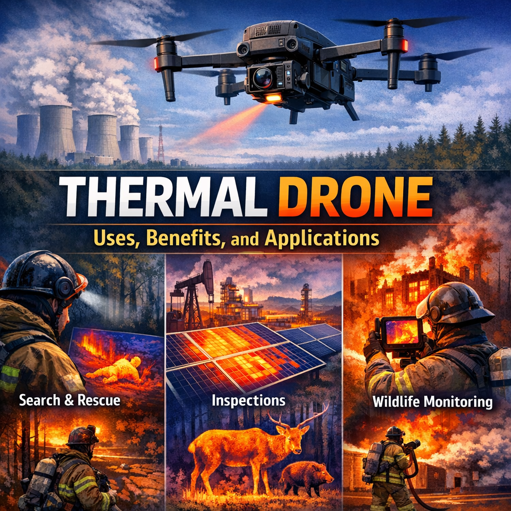
A thermal drone is one of the most useful tools in modern aerial inspection, search and rescue, agriculture, construction, and security. By combining the mobility of a drone with thermal imaging technology, it can detect heat signatures that the human eye cannot see. That means it can help locate people at night, identify overheating equipment, spot heat loss in buildings, monitor wildlife, and even support firefighting operations.
As drones have become more affordable and easier to fly, thermal drones have moved from niche industrial use into a broader range of everyday applications. Whether you are a business owner, an emergency responder, a farmer, or simply someone interested in drone technology, understanding what a thermal drone can do is increasingly valuable.
- What Is a Thermal Drone?
- How Thermal Imaging Works
- Key Uses of a Thermal Drone
- Advantages of Using a Thermal Drone
- Limitations and Challenges
- Choosing the Right Thermal Drone
- Best Practices for Using a Thermal Drone
- Real-World Examples
- Safety and Legal Considerations
- The Future of Thermal Drone Technology
What Is a Thermal Drone?
A thermal drone is an unmanned aerial vehicle equipped with a thermal imaging camera. Instead of capturing visible light like a standard camera, a thermal camera detects infrared radiation, which all objects emit based on their temperature.
This allows the drone to create a heat-based image, often called a thermogram or thermal map. Warmer objects appear in different colors than cooler ones, depending on the camera’s palette settings. In practice, this makes hidden or low-visibility details much easier to detect.
How It Differs from a Regular Drone
A standard drone camera records what the eye sees. A thermal drone records temperature differences.
That difference is critical in several scenarios:
- A person hidden in darkness or brush can still be visible as a heat source
- A leaking roof may show cooler damp spots
- A power line issue may reveal overheating components
- A crop field may show uneven irrigation or plant stress
In other words, a thermal drone does not just show images. It shows information.
How Thermal Imaging Works
Thermal imaging works by sensing infrared energy. Every object above absolute zero emits infrared radiation, and the amount emitted changes with temperature. Thermal sensors detect that energy and convert it into a visual image.
Basic Components
Most thermal drone systems include:
- Infrared thermal sensor: Captures heat data
- Optics: Focuses infrared energy onto the sensor
- Processing unit: Converts raw data into images or video
- Display or app interface: Shows thermal readings in real time
Some advanced drones combine thermal and visual cameras. This dual-sensor setup lets operators compare heat data with normal imagery, which improves accuracy and context.
Interpreting Thermal Images
Thermal images are not literal photographs. Bright or colorful areas represent relative temperature differences rather than specific colors in the real world.
Common display modes include:
- White hot: Hotter objects appear white
- Black hot: Hotter objects appear black
- Ironbow: Uses a colorful gradient to highlight temperature differences
- Rainbow or fusion modes: Combines visual and thermal data for easier analysis
Understanding these modes is essential for proper interpretation. A hot area does not always mean a problem, and a cooler area is not always safe. Context matters.
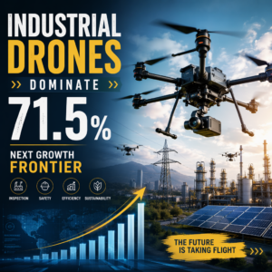
For a broader look at how drone platforms support inspection and operations, see this guide to industrial drone applications.
Key Uses of a Thermal Drone
Thermal drones are valuable because they can reveal conditions that are otherwise difficult or impossible to observe from the ground.
Search and Rescue
One of the most well-known applications of a thermal drone is search and rescue. In low light or dense environments, locating missing persons can be extremely difficult. A thermal drone can scan large areas quickly and detect body heat even in darkness.
For example:
- A lost hiker in a wooded area may be visible as a heat signature through gaps in vegetation
- A person stranded after a flood may be located on a roof or in debris
- A child missing at night may be found faster than by ground search alone
The ability to cover wide terrain rapidly can save precious time.
Firefighting and Emergency Response
Thermal drones help firefighters assess active fires, identify hotspots, and monitor the spread of flames without putting personnel in direct danger. They can also be used after a fire to detect smoldering areas that may reignite.
Emergency teams may use thermal drones to:
- Map fire boundaries
- Locate trapped or missing people
- Identify structural heat risks
- Monitor hazardous environments
This real-time overhead view improves situational awareness and supports safer decision-making.
Building Inspections and Energy Audits
Thermal drones are widely used in building maintenance and energy efficiency assessments. Heat loss often reveals itself through poor insulation, air leaks, moisture intrusion, or failing materials.
A thermal drone can help identify:
- Missing insulation in roofs or walls
- Air leaks around doors and windows
- Water damage beneath roofing materials
- Overheating HVAC components
- Moisture accumulation inside structures
For example, a commercial property manager may use a thermal drone to inspect a large warehouse roof without setting foot on it. That can reduce labor, increase speed, and minimize safety risks.
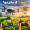
Agriculture and Crop Monitoring
Farmers and agronomists use thermal drones to monitor crop health and irrigation conditions. Plants under stress often show temperature differences before visible symptoms appear.
A thermal drone can help detect:
- Dry or poorly irrigated sections of a field
- Irrigation system failures
- Plant stress from pests or disease
- Livestock heat stress
- Fence line or perimeter issues
This can support precision agriculture, where interventions are targeted based on actual field conditions rather than assumptions. For more detail on field use, read our agricultural drones guide.
Power Line and Infrastructure Inspection
Inspecting utility infrastructure often involves tall structures, long spans, and potentially dangerous conditions. Thermal drones allow inspectors to detect overheating equipment from a safe distance.
They are commonly used to inspect:
- Power lines and transformers
- Substations
- Solar panels
- Wind turbines
- Industrial machinery
- Bridges and other large structures
Overheating in these systems can signal loose connections, mechanical wear, or electrical faults. Catching those issues early can prevent outages and expensive damage.
Wildlife and Environmental Monitoring
Thermal drones can also support conservation and environmental studies. Because animals often blend into their surroundings, thermal detection can improve observation without direct disturbance.
Uses include:
- Tracking nocturnal animals
- Counting wildlife populations
- Locating nests or burrows
- Monitoring invasive species
- Assessing habitat conditions
Environmental teams may also use thermal drones to study wildfire impacts, waterway temperatures, or land-use changes over time.
Security and Perimeter Checks
Security teams can use a thermal drone to scan large properties after dark or in poor visibility. Heat signatures make it easier to spot people, vehicles, or unusual activity along fences, storage yards, and remote access points.
This is especially helpful for facilities with limited lighting or large outdoor footprints. It also supports faster response when a ground patrol needs to confirm movement in a hard-to-reach area.
Disaster Assessment
After storms, floods, or wildfires, a thermal drone can help assess damage when access is limited. Crews can use the drone to identify hot zones, water intrusion, and unstable areas before sending people in.
That makes post-disaster inspection faster and safer. It also helps teams prioritize repairs and emergency support.
Advantages of Using a Thermal Drone
Thermal drones offer a combination of mobility, speed, and data collection that is difficult to match with ground-based tools.
Fast Area Coverage
A drone can cover large areas much faster than a person on foot. This is especially important in search and rescue, agriculture, and large-scale inspections.
Improved Safety
Thermal drones reduce the need for people to enter dangerous or unstable environments. They can inspect hot, contaminated, remote, or structurally risky areas from above.
Night and Low-Visibility Operation
Because thermal sensors do not rely on visible light, they can function at night, in smoke, and in some low-visibility conditions. That makes them especially useful when traditional cameras fail.
Better Data Collection
Thermal drones can capture repeatable, measurable data. When paired with mapping software, they can create reports, temperature overlays, and trend analyses that support long-term decision-making.
Cost Efficiency
Although thermal drone systems can be expensive upfront, they may reduce costs over time by speeding inspections, preventing failures, and limiting the need for specialized equipment or manual labor.
Useful for Industrial Workflows
Thermal imaging is especially effective when paired with broader industrial inspection methods. If you want a deeper look at enterprise use cases, review our industrial drone guide.
Limitations and Challenges
Despite their usefulness, thermal drones are not perfect. Understanding their limits is important for getting reliable results.
Not All Heat Is a Problem
Heat patterns must be interpreted carefully. A warm rooftop in the sun may not indicate an issue. Likewise, a cool patch may simply be shaded. Operators need training to avoid false conclusions.
Weather Can Affect Results
Thermal imaging can be influenced by:
- Rain
- Fog
- High humidity
- Wind
- Direct sunlight
- Reflective surfaces
These factors can distort readings or reduce clarity.
Resolution Matters
Lower-cost thermal cameras may have limited resolution, making it harder to identify small objects or subtle temperature differences. For professional work, sensor quality is crucial.
Range and Flight Time Constraints
Like all drones, thermal drones are limited by battery life, flight range, and payload capacity. Carrying a thermal camera can also reduce flight time compared to a lightweight camera-only drone.
Regulatory Restrictions
Drone operations are subject to aviation laws, privacy rules, and local restrictions. In some cases, flying at night, beyond visual line of sight, or over certain areas may require permission or certification.
For official rules in the United States, the FAA’s unmanned aircraft resource page is a helpful reference.
Choosing the Right Thermal Drone
Selecting the right thermal drone depends on how you plan to use it. A search and rescue team has different needs than a roofing contractor or a farmer.
Important Features to Consider
When evaluating thermal drones, look at the following:
Thermal Sensor Resolution
Higher resolution generally provides clearer images and better detail. Common options range from basic sensors to high-resolution professional systems.
Temperature Sensitivity
This is often measured as NETD, or noise equivalent temperature difference. Lower values usually mean better sensitivity to small temperature changes.
Dual Camera Capability
Many drones offer both thermal and visible-light cameras. This helps with object identification and report creation.
Flight Time
Longer battery life is especially valuable for larger inspections or field surveys.
Zoom and Imaging Modes
Optical zoom, digital zoom, and multiple thermal palettes can help with inspection accuracy.
Mapping and Software Support
Some drones integrate with software for thermal mapping, reporting, and data analysis.
Durability
If the drone will be used outdoors frequently, weather resistance and build quality matter.
Matching the Drone to the Job
Examples:
- Emergency services: Prioritize thermal sensitivity, quick deployment, and low-light performance
- Roofing and construction: Focus on image clarity, mapping, and report generation
- Agriculture: Look for wide-area coverage and reliable flight time
- Industrial inspection: Choose high-resolution sensors and precise temperature analysis
The best thermal drone is the one that fits the workflow, not just the one with the longest spec sheet.
Best Practices for Using a Thermal Drone
Getting good results requires more than owning the right equipment. Proper flight planning and image interpretation make a big difference.
Fly at the Right Time
For building inspections and energy audits, early morning or late evening often works best because the sun’s heat is less likely to interfere. For search and rescue, of course, timing depends on urgency.
Calibrate and Check Settings
Before a mission, make sure the thermal sensor is properly configured. Adjust:
- Temperature range
- Emissivity settings
- Color palette
- Focus
- Gain and contrast
Incorrect settings can make important details harder to see.
Understand the Environment
Always consider what may be affecting the thermal image. A black metal roof, wet soil, or reflective glass may create misleading readings.
Use Reference Points
Comparing suspect areas with normal areas nearby helps identify anomalies. For example, a hot bearing on a machine is more meaningful when compared to similar bearings on the same system.
Document and Verify Findings
Thermal images are useful, but they should often be verified by visual inspection or additional testing. Good documentation supports better decisions and helps create a record for future comparisons.
Train the Operator
Even the best hardware needs a skilled pilot. Training helps operators understand sensor settings, environmental effects, and the difference between a true anomaly and a normal heat pattern.
Create a Repeatable Workflow
For inspections, use the same altitude, route, and camera settings whenever possible. That consistency makes it easier to compare results over time and spot changes quickly.
Real-World Examples
Thermal drones are best understood through practical scenarios.
Example 1: Roof Leak Detection
A building inspector flies a thermal drone over a commercial roof after sunset. The thermal camera reveals a cooler section beneath the surface near a seam. That area likely contains moisture from a leak, which can be investigated before major damage occurs.
Example 2: Missing Hiker Recovery
A search team scans a wooded hillside at night. The thermal drone detects a warm figure lying under a tree line. Ground crews are then directed to the exact location, cutting search time dramatically.
Example 3: Crop Stress Monitoring
A farmer inspects a large cornfield. One section shows higher temperatures than the rest of the field, indicating water stress. The irrigation system in that zone is later found to have a blockage.
Example 4: Electrical Inspection
An industrial site uses a thermal drone to inspect a transformer. The camera reveals one component running significantly hotter than the others. Maintenance identifies a failing connection before a shutdown occurs.
Example 5: Warehouse Perimeter Scan
A security team flies a thermal drone around a warehouse at dusk. The drone spots an unexpected heat source near a back gate, allowing staff to verify the area before it becomes a larger issue.
These examples show how thermal drones can turn invisible problems into actionable insights.
Safety and Legal Considerations
Using a thermal drone responsibly means following safety and legal requirements.
Fly Legally
Always comply with local drone regulations, which may cover:
- Registration
- Licensing or certification
- Altitude limits
- Night operations
- Restricted airspace
- Flights over people or private property
Respect Privacy
Thermal drones can capture information that people may consider sensitive. Avoid unnecessary surveillance and follow privacy rules when operating near homes or public spaces.
Maintain Visual Awareness
Even if the thermal camera is the main tool, the pilot must still maintain situational awareness to avoid obstacles, power lines, birds, and other aircraft.
Keep Equipment Maintained
Inspect batteries, propellers, sensors, and gimbals regularly. A thermal drone is only useful when it is reliable and ready for deployment.
Follow Site Rules
Work sites, utilities, and emergency zones may have their own access rules. Coordinate with the responsible team before launch so the mission stays safe and organized.
The Future of Thermal Drone Technology
Thermal drones are likely to become even more capable in the coming years. Improvements in sensor quality, onboard processing, battery life, and AI-assisted analysis will expand what these systems can do.
Expected Developments
- Higher-resolution thermal sensors
- Smarter automated anomaly detection
- Better integration with mapping and reporting tools
- Longer flight times
- Improved obstacle avoidance
- Wider adoption across industries
As costs continue to fall and technology matures, thermal drones will likely become standard equipment in many inspection and response workflows.
They may also connect more deeply with artificial intelligence and cloud platforms. That could make it easier to flag hot spots automatically, compare old and new scans, and share findings with teams in real time.
Conclusion
A thermal drone is more than a flying camera. It is a powerful sensing tool that can reveal heat patterns, detect hidden issues, improve safety, and speed up decision-making across many industries. From search and rescue to agriculture, construction, energy, and environmental monitoring, its applications are broad and practical.
The key to getting real value from a thermal drone is understanding both its strengths and its limits. With the right equipment, proper training, and careful interpretation, thermal imaging can turn unseen problems into clear action.
For buyers comparing inspection platforms, the right choice depends on your workflow, environment, and reporting needs. A well-matched thermal drone can deliver safer results and more useful data for years to come.


Add comment